 |
|
|
° HOME
° DEFINITION ° BROWSE ° REPORT ° TOURS ° CONTACT ° MISC |
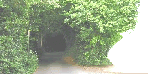
Browse through the database of urban country lanes.
|
||||||||||||||||||||||||||||||||||||||||||||||||||||||||||||||||||||||||||||||||||||||||||||||||||||||
|
||||||||||||||||||||||||||||||||||||||||||||||||||||||||||||||||||||||||||||||||||||||||||||||||||||||||
|
||||||||||||||||||||||||||||||||||||||||||||||||||||||||||||||||||||||||||||||||||||||||||||||||||||||||

|
Site designed, owned and maintained by Stephen Battey. ©2005, 2006 Stephen Battey |